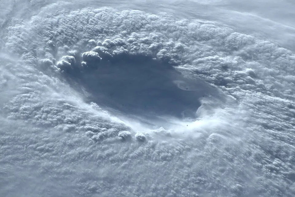
China is having a genuinely terrible typhoon season, and it is not done yet. Typhoon Noul is charging toward the southern coast with 90 mph sustained winds and enough rain to make Guangdong province wish it had somewhere else to be. More than 340,000 people have already been evacuated, and the storm hasn't even made landfall.
What's Coming and When
According to CBS News, Hong Kong's Observatory tracked Noul moving across the South China Sea on Saturday, with its center closing in on the Guangdong coastline. The storm is expected to make landfall Sunday morning near the southern Chinese cities of Huizhou and Shanwei before pushing inland and dragging its wind and rain with it.
China's National Meteorological Center is warning that parts of southern Guangdong and southeastern Fujian provinces are in the crosshairs for heavy rain and serious winds over the weekend. This isn't a glancing blow situation. The storm is aimed, and authorities know it.
Mainland Chinese officials issued their highest-tier red typhoon alert Saturday evening. Hong Kong's observatory hoisted storm signal No. 8, which is the third-highest level in the city's alert system. That's the kind of number that empties streets.
The Evacuation Numbers Are Staggering
CBS News reports that more than 340,000 people had been moved out of Guangdong province by Saturday afternoon alone, citing state broadcaster CCTV. That is not a small logistical operation. That is a small city's worth of people being told to grab what they can and go.
Train services across the province have been canceled for Sunday, according to the China News Service. Hong Kong's airport had already scrubbed more than 150 flights for Saturday and Sunday combined, with officials warning that number could climb as the storm gets closer. When an international hub like Hong Kong starts hemorrhaging flights, you know the situation is serious.
Part of a large scaffolding on a Hong Kong high-rise building collapsed Saturday afternoon as the outer winds started picking up, according to local police. No injuries were reported initially, but this is the kind of warning shot that tends to come before worse things happen.
This Is the Third Strike for China This Month
Here's where the story gets grimly absurd. CBS News notes that Typhoon Noul is the third significant storm to hammer China in July alone. Typhoon Maysak made landfall in southern China on July 3. Typhoon Bavi followed on July 11 and was severe enough to force the evacuation of more than 2 million people across eastern China.
Let that sink in. More than 2 million evacuations from one storm earlier this month, and now China is back at it less than two weeks later with a fresh typhoon bearing down. Southern China has been in emergency mode for nearly the entire month of July.
Taiwan got some of Noul's rain as the storm passed south of the island, according to the Central Weather Administration there, but the island was tracking away from the worst of it by Saturday. Taiwan has enough experience with typhoons to know when it's not its problem this time.
What 90 mph Winds Actually Mean
The 90 mph sustained winds near Noul's center are not a metaphor. That is strong enough to tear roofing, topple trees, and turn loose debris into projectiles. The scaffolding collapse in Hong Kong before the storm even arrived tells you something about what conditions are going to look like when it does.
The fact that China issued its red alert, the top of the scale, signals that meteorologists are not treating this as a manageable inconvenience. Red alerts in China's typhoon system are reserved for storms that pose serious threats to life and infrastructure. Officials don't hand those out for storms that are mostly going to ruin someone's weekend.
The Dingo Take
Three typhoons in one month. Three. China's southern coast has been getting absolutely pummeled since July started, and the cumulative toll in disruption, displacement, and infrastructure stress is something that doesn't get communicated well by individual storm headlines. Noul is not just a story about this weekend. It's a story about a region that has been in near-constant emergency response mode for weeks, with no sign the Pacific is going to stop producing these things anytime soon.
The climate context is not incidental here. The South China Sea has been running hotter than average, and warmer water is fuel for typhoons. Scientists have been saying for years that warming oceans would produce stronger, more intense storms. We are watching that prediction become a recurring logistical nightmare for one of the world's most densely populated coastlines. The 340,000 people evacuated from Guangdong this weekend didn't do anything wrong. They just live somewhere that is increasingly in the crosshairs.
Watch the landfall numbers when they come in Sunday. Watch whether Noul holds its intensity or strengthens further overnight. And consider that somewhere in the Pacific right now, there is almost certainly another system forming. July has three weeks left.





Comments