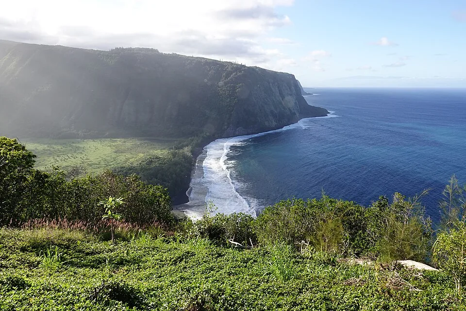
A tropical storm that didn't even exist 48 hours ago is about to become a hurricane and park itself directly over one of the most geographically vulnerable places on Earth. Tropical Storm Lala formed Thursday in the Pacific, and forecasters are warning it could dump up to 25 inches of rain on Hawaii's Big Island by the weekend. Life-threatening flooding and mudslides are on the table.
What Lala Is and Where It's Headed
As of Thursday evening local time, CBS News reports that Lala was sitting roughly 555 miles south-southeast of Hilo, churning northwest with maximum sustained winds of 60 mph. That's tropical storm territory right now. But the National Hurricane Center, based in Miami, expects it to cross the 74 mph threshold that earns a storm a full hurricane designation before it reaches the islands.
The forecast track puts Lala near or just south of the Big Island on Saturday, then tracking south of the smaller islands through the rest of the weekend. That positioning matters. Rain doesn't politely stop at sea level in Hawaii. The islands are essentially mountains sticking out of the ocean, and when a moisture-laden storm wraps around terrain like that, the numbers get ugly fast.
The National Hurricane Center flagged something specific that's easy to overlook in the broader forecast: wind speeds on the windward sides of hills and mountains can run up to 30% stronger than the near-surface winds in the official forecast. So when they say 74 mph sustained winds, parts of the Big Island could be dealing with something closer to 95.
The Rain Numbers Are the Real Story
The wind is bad. The rain is worse. Forecasters are projecting 5 to 10 inches of rainfall across the Hawaiian Islands as a baseline, with localized totals potentially reaching 25 inches in the hardest-hit areas. Twenty-five inches. That's more rain than Seattle gets in an average four-month stretch, compressed into a single weekend storm event.
The National Weather Service did not sugarcoat what that means. "This rainfall may produce life-threatening flooding and mudslides, especially in areas of steep terrain," the agency said. Hawaii is almost entirely steep terrain. There is no part of this that sounds fine.
Rain events of this magnitude in Hawaii have a history of triggering flash floods that move faster than people can respond to them. The Big Island's landscape, volcanic rock covered in varying degrees of soil, does not absorb water like a prairie. It sheds it, fast and hard, down ravines and gullies toward populated areas below.
The State Is Already Moving
Hawaii Governor Josh Green signed a state of emergency proclamation Thursday, ahead of the storm's arrival. According to CBS News, the declaration activates potential disaster relief funds and directs all state agencies to cooperate and make their resources available for emergency response. This is the right call, made early enough to matter, which is more than can be said for some disaster responses we've watched play out in recent years.
The National Park Service also announced it would close most areas of Volcanoes National Park on the Big Island by Friday afternoon. If you had plans to watch lava flows this weekend, those plans are cancelled. If you are currently in the park, you should not need a federal agency to tell you twice to leave before a hurricane arrives.
Meanwhile, Also in the Pacific
Because one storm at a time is apparently not on the menu this week, Tropical Storm Hernan also formed Thursday, roughly 1,460 miles west of the southern tip of Baja California. CBS News notes that Hernan is not expected to threaten land. We mention it here because the Pacific Ocean is apparently running a two-for-one special on named storms this week, and it felt dishonest not to acknowledge that.
Hernan requires no immediate action from anyone reading this. Lala very much does if you are in Hawaii.
What People in the Storm Zone Need to Know
A hurricane warning is in effect for the Big Island. That is the highest level of alert the National Hurricane Center issues. A tropical storm watch covers Maui County, which includes Maui, Lanai, Molokai, and Kahoolawe. The distinction matters: a warning means conditions are expected. A watch means they're possible. Both should be taken seriously.
Rain is set to begin arriving late Friday. That gives people in affected areas a shrinking but real window to prepare. Stock water, charge devices, know your evacuation routes if you're in a flood-prone area, and for the love of everything do not attempt to drive through flooded roads. More people die in flood events from exactly that decision than from almost any other single factor.
The Dingo Take
You are supposed to believe that because this storm is tracking just south of most of the islands, it's somehow a near-miss. Read the forecast again. Twenty-five inches of rain on terrain that is essentially a series of volcanic mountains is not a near-miss. It is a slow-motion flood event with a very specific arrival time, and the only variable is exactly how bad it gets in which neighborhoods.
The early state of emergency declaration from Governor Green is genuinely the correct move, and it's worth saying that plainly because we live in an era where basic competent governance has become remarkable enough to comment on. Getting resources pre-positioned before a storm instead of scrambling afterward is how this is supposed to work. Whether the execution matches the paperwork is what the next 72 hours will tell us.
Hawaii is still carrying scars from past disasters, including the 2023 Maui wildfires that killed more than 100 people and exposed catastrophic failures in emergency response and warning systems. The state cannot afford another one of those moments. The storm is coming regardless. What happens next depends entirely on whether the preparation was real.



Comments