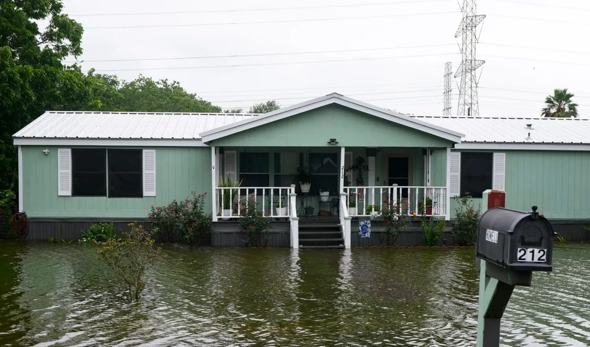
Tropical Storm Arthur made landfall along the upper Texas coast on Thursday, got downgraded from a cyclone to a low pressure area almost immediately, and then proceeded to absolutely drown the Gulf South anyway. Life-threatening flooding is spreading across Louisiana, Mississippi, Alabama, Georgia and the Florida Panhandle, because apparently the storm didn't get the memo about being weakened. Three inches of rain per hour in some places. The season's first named storm is making itself known.
What Arthur Lost in Wind, It Made Up in Water
The National Hurricane Center confirmed Thursday that Arthur's maximum sustained winds dropped to around 35 mph as it came ashore, which sounds almost polite until you look at what it's doing on the ground. The Guardian reports that forecasters are warning of 4 to 8 inches of rain, and in some spots considerably more, falling across a wide stretch of the southeast through Friday.
Flash flooding, tornado warnings, and widespread power outages hit Louisiana and Mississippi on Thursday as rain fell at rates of up to 3 inches an hour. That is not a typo. Three inches. Per hour. And this was on top of heavy rain the region had already absorbed earlier in the week, because nature apparently decided the Gulf South needed a stress test.
All coastal watches and warnings were discontinued Wednesday, which probably felt like good news for about twelve hours before the flooding started. The National Hurricane Center said flooding remains likely through Friday across Texas, Louisiana, Mississippi, Georgia, and the Florida Panhandle.
The Director of the Hurricane Center Said 'Dangerous to Life-Threatening.' Listen to the Man.
National Hurricane Center director Michael Brennan did not mince words. According to The Guardian, Brennan described Arthur's main threat as "a prolonged, multiday, heavy rainfall event that could produce dangerous to life-threatening flash flooding." That is a federal meteorologist using the phrase "life-threatening" twice in one sentence.
Some communities in Louisiana and Mississippi were ahead of the game, distributing sandbags to residents and clearing debris from drainage systems before Arthur made its move. That kind of preparation matters in a region that has been here before and knows exactly how fast a bad rain event can become a catastrophe.
Meanwhile, the Midwest Got Its Own Weather Emergency
Arthur wasn't the only story Thursday. More than 130,000 homes and businesses lost power across Illinois, Indiana, Michigan, Kentucky, Ohio and West Virginia, according to poweroutage.us, courtesy of a separate round of severe storms ripping through the region.
A tornado touched down Wednesday evening near Effingham, Illinois, about 90 miles southeast of Springfield. Several people suffered minor injuries. Effingham fire chief Brant Yochum told The Guardian that firefighters responded to damaged homes, collapsed structures, car crashes, downed power lines, gas leaks, and blocked roads. Florence, Kentucky, near Cincinnati, also took wind and possible tornado damage, with news footage showing roofs and siding stripped off homes and trees down across neighborhoods.
The weather service reported wind damage across a massive stretch of the country, from Iowa and Missouri all the way east to Ohio and West Virginia. The storm system was expected to push through the central Appalachians into New England by Thursday. So, basically, a significant portion of the continental United States had a bad weather day.
The First Named Storm of Atlantic Season, and It's Already Complicated
Arthur is the Atlantic basin's first named tropical storm of the 2026 season. It is not, as far as anyone hoped, a quiet opener. The Guardian reports forecasters expect it to continue weakening as it drags across southeastern Texas and western Louisiana before crossing the broader Southeast, but weakening in wind speed has not meant weakening in impact.
The storm's remnants are doing the work now. Even a disorganized low pressure blob carrying this much moisture and moving this slowly through saturated ground can cause property damage, disrupt travel, and endanger lives. Which is exactly what forecasters said it would do. It's almost like when experts say "life-threatening flooding," they mean it.
The Dingo Take
Here's the thing about Tropical Storm Arthur that should stick with you: the storm got downgraded before it even finished making landfall, and it is still flooding out multiple states. That's the story of modern extreme weather in a nutshell. The old categories and thresholds we use to communicate danger were built for a different era of storms. A system can lose its official punch and still drop three inches of rain an hour on communities sitting on already-saturated ground. The wind speed headline doesn't tell you what the water is doing.
And while Arthur is battering the Gulf South, the Midwest is simultaneously dealing with tornadoes, 130,000 households without power, collapsed structures, and gas leaks. Two major weather disasters, same day, different systems, different regions. This is the part where someone in a position of authority should probably be paying very close attention to infrastructure resilience and emergency response capacity. Someone should be. Whether someone actually is, in the current federal environment, is a separate and considerably more uncomfortable question.
In the meantime, if you're in Louisiana, Mississippi, Georgia, the Florida Panhandle, or anywhere else in Arthur's soggy path, the National Hurricane Center director used the phrase "life-threatening" and he was not doing it for dramatic effect. Get to higher ground if you need to. The storm may be downgraded. The water is real.




Comments